
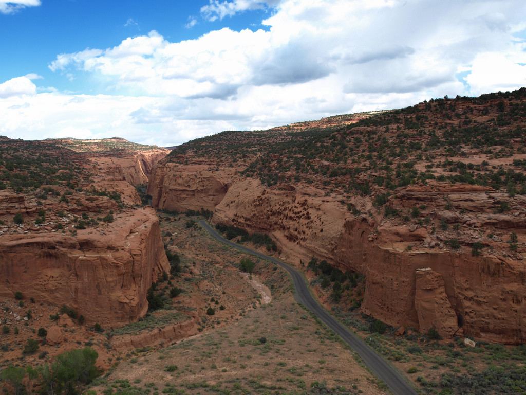
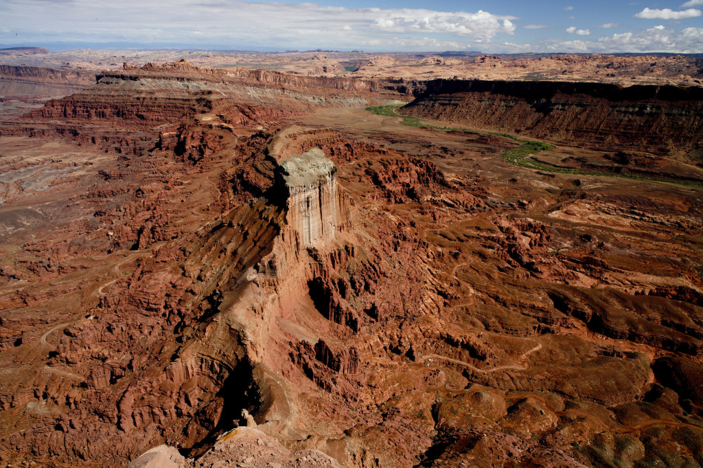
Did you ever want to drive across wide deserts and red canyons, through a thrilling and dangerous road, just relaying on your own skills and your trusted car? If your answer is yes, then look no further: the Burr Trail in Utah is made just for you.
The Burr Trail is only for the most adventurous drivers, so it is a perfect choice for an adventure rally through the Wild West. This tricky road will take you across some of the most beautiful and breathtaking landscapes of the state of Utah, and will give you an instant and amazing adrenaline shot at the same time.
The Burr Trail was named after John Atlantic Burr, a man born in 1846 aboard the ship SS Brooklyn while it was sailing somewhere in the Atlantic Ocean. He eventually moved to the south, to Utah, where he developed a trail to move cattle through the rough and almost impassible country that crossed the territories of Waterpocket Fold and Muley Twist Canyon. This trail would be known from then on as the Burr Trail. Of course, today there are better ways to transport cattle; but still, the trail remains there for adventurers to cross!
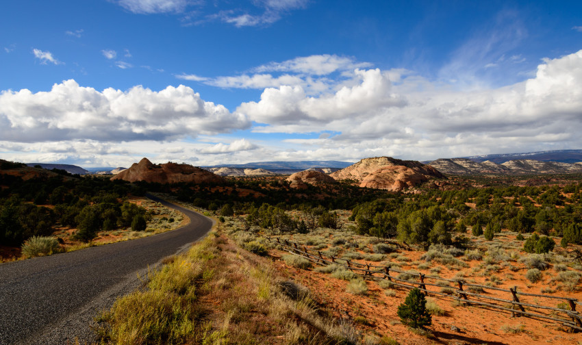
Over view of the Burr Trail. Photo by pspechtenhauser.
Nowadays the road brings together the towns of Bullfrog and Boulder, both in Utah. On the way, it crosses the country of the Glenn Canyon Recreational Area, the Capitol Reef National Park and the Grand Staircase Escalante National Monument. Also, you will get amazing views from the trail of the Henry Mountains, Waterpocket Fold, Red Circle Cliffs and the Long Canyon.
You should be careful when crossing the Burr Trail, as it is not made for any kind of car. You should always check the weather with the local rangers, as a rainy day can make the route almost inaccessible even for 4WD cars.

What will you see from the Burr Trail
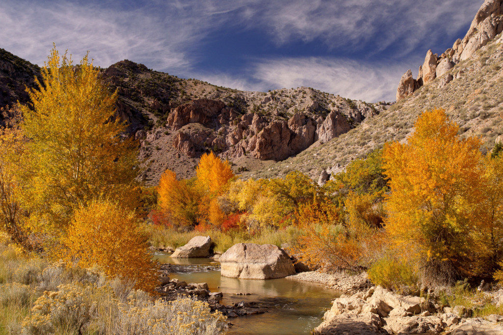
Henry Mountains
Once called “Mountains with no name” by the Navajo Indians, they are a huge set of mountains surrounded by the Fremont River, the Dirty Devil River and Lake Powell. They are the home of 350 American bisons, which have recently been shown to be one of only four free-roaming and genetically purebred bison herds on public lands in North America.
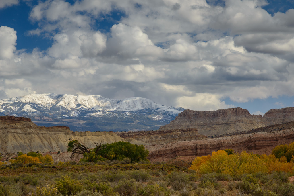
Henry Mountains. Photo by John Buie.
Waterpocket Fold
This monoclonal fold extends across more or less 100 miles, and defines the area of the Capitol Reed National Park. It is arid like a desert, and very famous among hikers for its amazing routes. The so called Golden Throne is a famous landmark out of beautiful golden sandstone.
Waterpocket Fold. Photo by Wolfgang Staudt
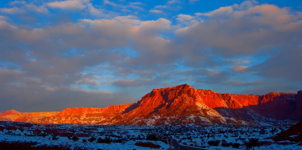
Red Circle Cliffs
The Red Circle Cliffs of Utah are a unique Jurassic formation 450 feet thick and composed of red and light-blue sandy shale, siliceous limestone, sandstone, and gypsum. The composition of the minerals gives the cliffs a stunning reddish color that is impressive to watch, especially during the sunsets in the desert.
Red Circle Cliffs. Photo by Bureau of Land Management.
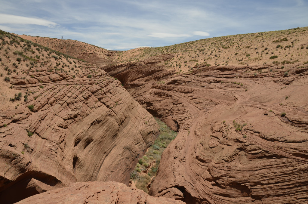
Long Canyon
Long Canyon is an extensive tributary of White Canyon, near the northeast end of Lake Powell, and has many short narrow sections, with pools and dryfalls.
Long Canyon. Photo by PiConsti
Glenn Canyon Recreational Area
The Glenn Canyon Recreational Area is a recreations and conservation unit of the National Park Service of the USA. It consists of the area surrounding the Lake Powell and lower Cataract Canyon in Utah and part of Arizona. Most of the area is a huge desert. Still it offers lots of recreational activities and includes a Navajo Indian Reservation, marinas, camping grounds, airports and houseboat rental concessions.
Glenn Canyon. Photo by Pridhvi Dandu
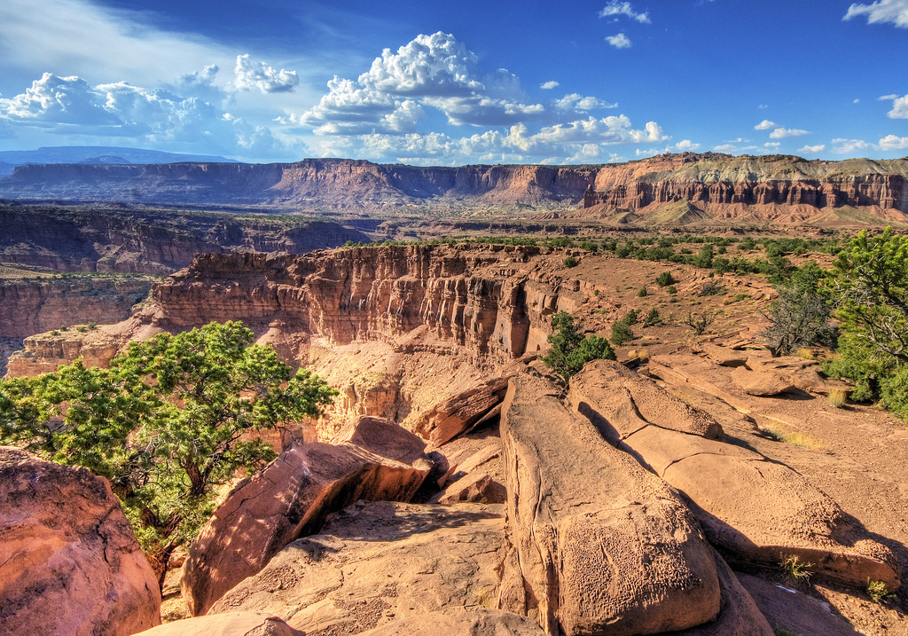
Capitol Reef National Park
The Capitol Reef National Park takes an area of 60 miles and composes a breath taking scenery to watch. The park is named after the line of cliffs of white Navajo Sandstone with dome formations- these look like the white domes that were often placed in the capitol buildings. The Waterpocket Fold is technically included in the park area, but it is a landmark of its own.
Capitol Reef National Park. Photo by Esther Lee
Grand Staircase Escalante National Monument
This impressive US National Monument includes three main regions: the Grand Staircase, the Kaiparowits Plateau, and the Canyons of the Escalante. It is, in total, the widest national monument in the whole United States. It includes wide canyons, old settlements, and geological formations such as the funny hoodoos. Important paleontology discoveries have been made in the area, as well as human historical remains of the Fremont and ancestral people that used to live in there thousands of years ago.
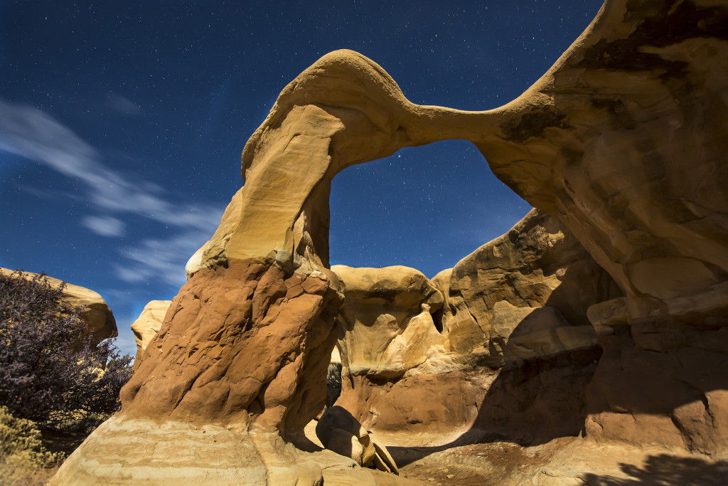
Grand Staircase-Escalante National Monument. Photo by Bureau of Land Management.
Are you already feeling the wheels of your car roaring below you while you drive across these awesome places? Join our rally group through the Wild West and get to drive across the Burr Trail with a bunch of other adventure lovers, in a route that will bring you from Hollywood to Las Vegas across the southwest of the US!