
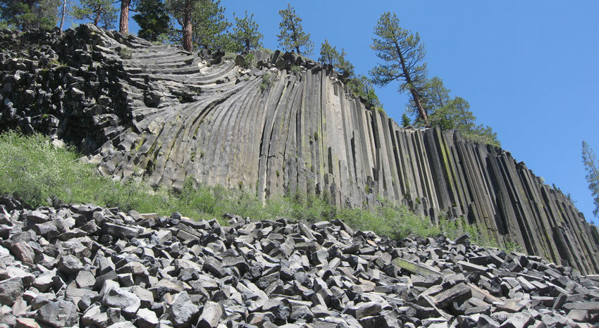
Devil’s Postpile is an under-10km hike. There is spectacular Sierra scenery all around, with several waterfalls, the wild and scenic San Joaquin River, and the Postpile itself – a breathtaking example of columnar basalt.
Photo by ((brian))
How long a hike is it?
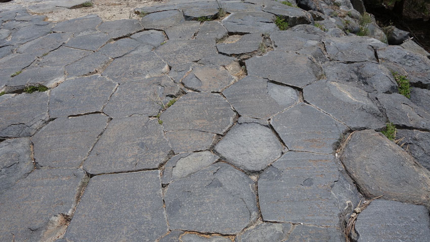
Photo by tosh chiang
Three hours minimum, with time for waterfall-gazing and breaks. Covers a distance of just under 10 km, with an elevation gain of
167 metres. A moderately difficult hike; trail condition is very good and the path is pretty easy to follow, but there are numerous trail junctions with other trails along the way. Thankfully, everything is well marked.
Also important to know that The Devil’s Postpile gets a ton of snow, so it is normally only open from mid-June to early October. Before you head there, check with the Rangers by visiting the Monument’s website or calling 760-934-2289. If you plan on using the shuttle service, you should also call that number for rates and schedules.
How to get there?
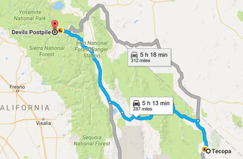
Photo by Google maps
From Tecopa, drive up CA-127 to the Death Valley Junction, then head west on CA-190 to Lone pipe, then turn north and follow CA- 395 until you reach the Mammoth Mountain Ski Area. You’ll have to park your car here and take the shuttle into the Monument itself.
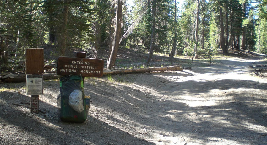
Photo by Leif
What to expect?
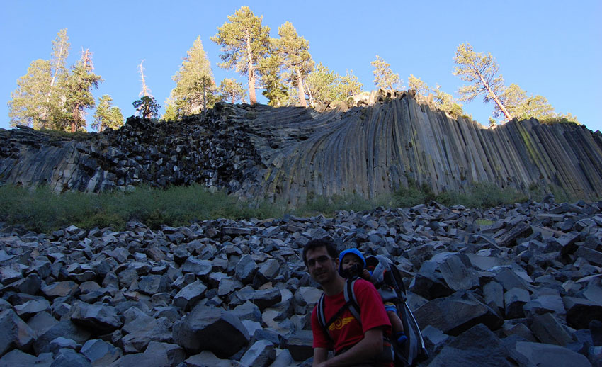
Photo by Gabriel Rodriguez
Today, the monument is a great place to hike. After you leave your vehicle at the Mammoth Mountain ski area and take the treacherous shuttle ride into the park, you can start hiking at a number of stops along the way. For this route, take the shuttle to stop six – the Ranger Station – then tighten up your boots.
The Postpile itself is only 600 metres from this spot, so expect some heavy foot traffic on the early stretch of the trail. Enjoy the level and easy hiking path, and be sure to look to your right to see a bend in the San Joaquin River, which ends up irrigating a great proportion of the San Joaquin Valley to the west.
In only 600 metres, you’ll reach the Devil’s Postpile, an 18-metre high wall of columnar basalt. Do hike around the bottom of the formation for some great perspective on the columns, which was created when uniform density lava cooled under massive pressure. Many of the hexagonal chunks at the base of the cliffs are taller than a person!

Impressive.
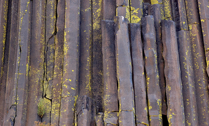
Photo by jcookfisher
When you’re done soaking in its grandeur, be sure to backtrack to the northern edge of the formation for a quick climb to the top of the Postpile. It’s one of the steepest climbs on this route, but it’s manageable. When you get to the top, you’ll have some pretty nice views of The Buttresses to your west, and of the smooth top of the basalt piles, worn down by a massive glacier.
The path descends to the south of the Postpile and carries on south, popping in and out of the National Monument boundary. At the three-way junction, keep right and ignore the path to Reds Meadow to carry on toward Rainbow Falls.
This section of the path is a gently descending route through some very pleasant woodland before you hit some of the remnants of the 1992 fire, which destroyed more than 80% of the Monument.
Fortunately, the forest is definitely on the rebound, but even 24 years after the blaze, parts of it are still pretty barren. Nature can and does repair itself, but it doesn’t work on a human time scale.
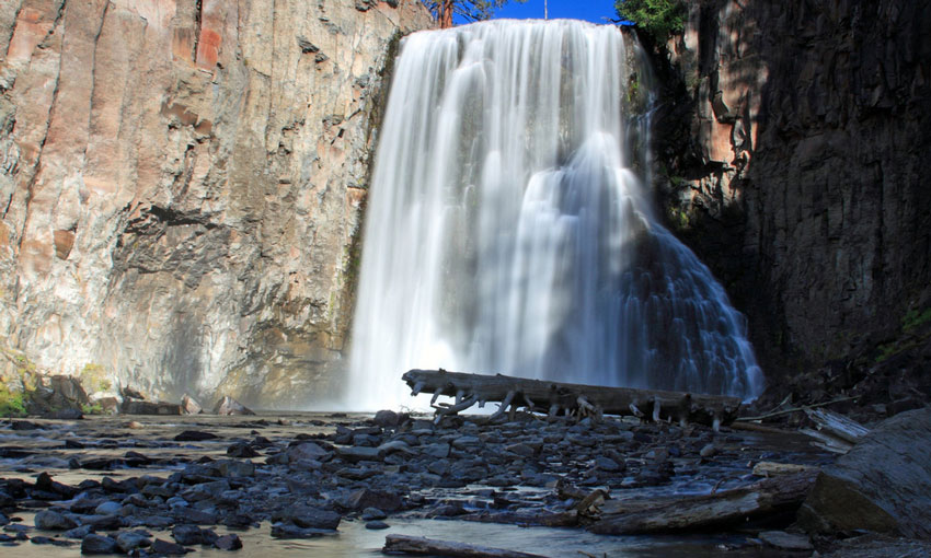
Photo by Frank Kovalchek
At about the 4 km mark, continue right at the three-way junction to enter the John Muir Wilderness and head on toward Rainbow Falls. Cross Boundary Creek and stay at the junction. You’ll hear the roar of Rainbow Falls before you can see it – and when you finally do see the 30-metre tall cascades, it’s very impressive.
I bet.
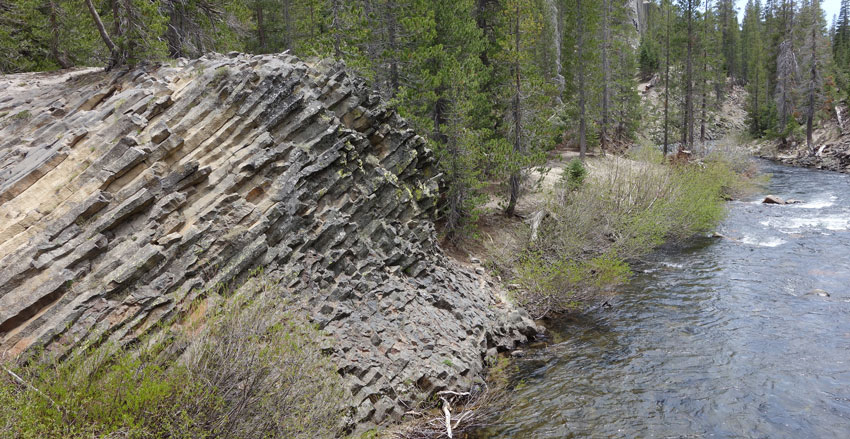
Photo by tosh chiang
There’s a very pleasant overlook of the falls from the edge of the river canyon, and you can also hike down a steep path cut into the canyon wall to get down to the bottom of the falls. It’s well worth the effort.
When you’re done, backtrack toward Rainbow Falls, but this time veer to the right after crossing Boundary Creek. The path climbs back up to Minaret Road at Reds Meadow Resort – a small stable and general store.
Chill out a little here and grab a bite to eat, or simply wait for the Shuttle to make another round to take you back to your car and rejoin some of your Wild West Challenge teammates.