
As you leave Tecopa and head into the depths of Death Valley, the lowest, hottest, driest, and largest National Park, you’ll be treated to an otherworldly landscape of badlands, sand dunes, and hidden oases just begging to be explored on foot. We’ll continue our Death Valley hiking series with a spot of trail-less hiking in the depths of Ashford Canyon.
Photo by a.dombrowski
Trail-less? So how does that work?
Photo by Tom Babich
The route just follows Ashford Canyon and some relics of the old mining road (where it has not been washed out). The main canyon is easy enough to follow. The canyon floor is mostly open and quite easily to navigate, but there are a few minor rock scrambles too. This might be a bonus for you, and even more so if rock climbing is your thing.
How to get there?
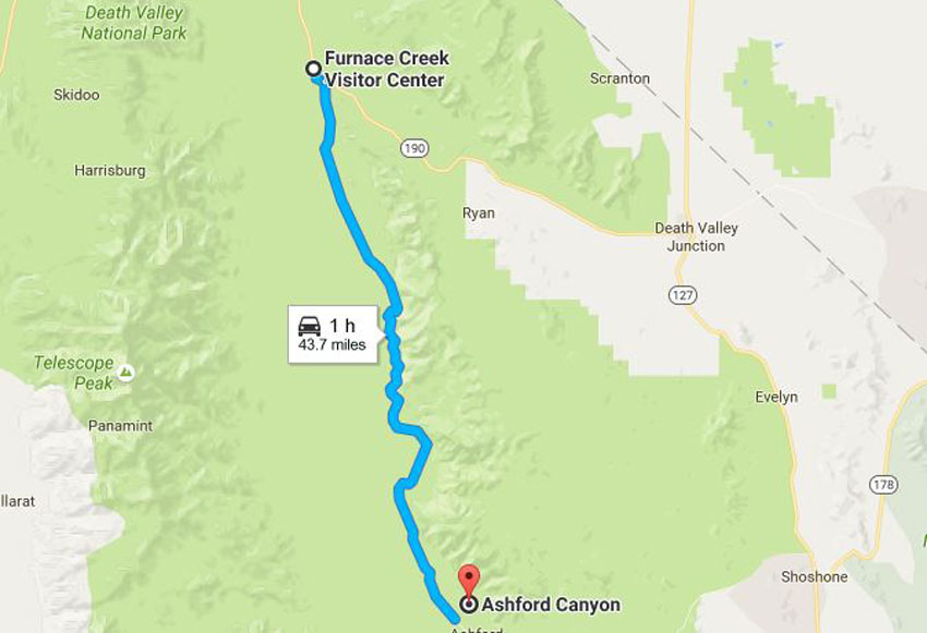
Photo by Google maps
From the Furnace Creek Visitor Center, follow Badwater Road (Highway 178) 70 km south from its intersection with Highway 190 til you reach a faint access road. This access road is an unsigned, unmaintained dirt track on the east (left) side of the Badwater Road across from the Ashford Mill ruins. Drive down the access road towards the mountains for 4.5 km to a small parking area and the trailhead itself. The road is navigable with a regular car for the first km or so, but then it becomes rocky and sandy. You’ll need high clearance to get to the the trailhead. There are also places where you can turn around or park and continue on foot if the road gets too rough.
Where does Ashford Canyon get its name?
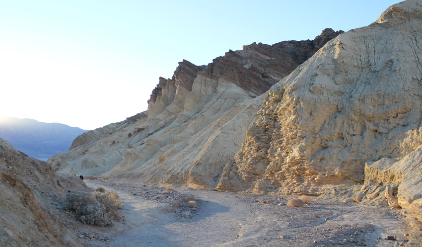
Photo by a.dombrowski
For every happy story of lucky prospectors and rich strikes in Death Valley’s mining history, there are ten untold stories of lost fortunes. The Ashford Mine started in 1907, when Harold Ashford was prospecting in the area. Most of the land had already been claimed, but the owners hadn’t done the necessary annual assessment work to keep the company claims.
Harold got wind of this and started working the claims with his brothers. Though he was later taken to court, he won title to the land in 1910. From then on, he and his brothers worked the Ashford Mine with not too much to show for it, but enough promise that enabled them to lease the mine in 1914 to an investor from L.A., Benjamin McCausland and his son.
The McCauslands built a a mill and road, and employed 28 men, but they still couldn’t break even, so they turned the land and equipment back over to the Ashfords, who held onto the property and leased and worked it intermittently, but mostly it sat idle. Sadly, the mine never broke even and was eventually closed for good in the 1950s.
What condition is it all in now?
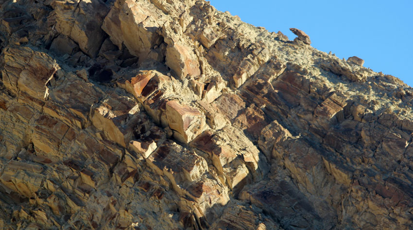
Photo by a.dombrowski
The ruins are well-preserved and picturesque, a gold mine hidden high in the Black Mountains of Death Valley. Reaching it requires a steep, scenic, 7 km long hike through Ashford Canyon, a very colorful canyon of jumbled rocks. You’ll need three hours for this hike, four if you want to explore the camp well.
As you walk the canyon, it’s easy to see how much effort it must have taken to develop this place, far from civilization and any infrastructure. The almost-trail starts on the east side of the small parking lot, marked with a wilderness boundary marker. Then it quickly drops down into the wash of Ashford Canyon.
Quite soon (after about 500 metres) look for the traces of the old mining road on your left. It was built in 1915 and has since suffered some major washouts. You might have to adjust your expectations for what a road looks like (in this case, a flat place running along the hill). If you miss your turn, you’ll end up at a high fall in about 700 metres. If you are rock climbers, this might be a welcome obstacle. The fall is doable with equipment and rock climbing skills. Otherwise, if you follow the old road, it bypasses the wash to meet the main canyon above the fall.
Keep following the canyon and bits of the old road as its remaining segments appear and disappear. In places they’re hard to tell apart from the beds of stone that blanket sections of the canyon floor. The scenery in the canyon is beautiful with sand-gold walls that reflect the shifting sunlight and ancient rock, some of the oldest exposed rocks in Death Valley.
The layers of conglomerate stone underfoot are full of many textures and colors with gneiss, mica, feldspar, and quartz. They’ve been sculpted by water into polished mosaics.

Wow.
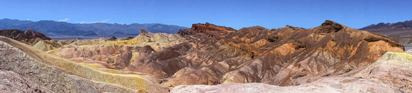
Photo by Alan Eng
As you hike, look for two intersecting side canyons. The first side canyon intersects the main canyon at just under the 2 km mark. The second side canyon spurs off at about 2.5 km, the cue that you’re close to the mine road and camp. Then the road resumes on the right side of the wash at about the 2.8 km mark. After a short distance, it swings across the wash and intersects the canyon on the northern (left) side. Follow it to climb the steep, half-a-km ascent up and over the canyon wall.
When you reach it, the Ashford Mine camp is a strangely moving sight, nestled in its forgotten ring of hills, exposed to the relentless wind and sun. When the camp comes into view, the road winds along the hillside, past old dugouts and cabins, still standing and partially furnished, telling of life in a lonely mining camp. Take time to explore well before you make the trek back down the canyon. On your way out, check out the Ashford Mill ruins across the Badwater Road – then rejoin the other teams of the Wild West Challenge and tell them all about it!